Tuesday, October 21, 2008

Canyon Country

9 am sharp at the Outpost I met Janice. I made a clutch decision to grab a box of cheezits out of my truck. We drove up the slope leading into the Bankhead, discussing the hundreds of semis that thundered through this stretch in excess of 60 miles an hour, fully loaded with wood chips for the sawmill to the south. The night prior I listened to them from my campsite all through the night. Just passing into the forest boundary we pulled off onto a rutted driveway-the home of Barb (Bob), the leader of today's hike, and her husband Jim, a tall, thick man who introduced himself with the confidence of stubborn wisdom, pronouncing his full name. At the terminus of their driveway were several vehicles, boats and canoes. An old shed was tucked under some oaks next to, of all things, a faded Kerry/Edwards roadside banner. There I was introduced to Bob, Jim and Ted and we were promptly on our way. Jim stayed home with their 3 month old boxer puppy.

I learned quickly that these folks rarely hiked in the Sipsey wilderness, and for that matter, rarely hiked on a trail. Today we would be bushwacking, following a number of draws, as Bob called them, (creeks) into several canyons, and eventually to the Sispsey river where a couple miles upstream another car was left as a shuttle.

Waiting for Bob and another hiker to complete the shuttle we poked around the roadside. Janice found the first of many musclodine vines, and went haywire upon their discovery. Musclodines are like purple grapes in appearance. They have a stiff skin that you squeeze to pop the gelatenous insides into your mouth. Their flavor reminds me of the taste all commercial grape products try to emulate but fall short. They surpass any other excuse for a grape. I was impressed. As we picked them I looked down and noticed a spider the size of which I haven't seen in years. It was a Cave spider about the size of an egg yolk, black, with hearty legs. I bent down to snap a picture and it scuttled into its tunnel where its legs can barely be seen. You can imagine how it hunts. Makes me happy I'm not an insect.

Bob arrived with another hiker Kathy and her labradoodle Ponchy. We promptly dropped into the woods with hardly a hello and were pushing through brush down toward the first canyon rim. Little did I know these were the first steps of an epic dayhike. Soon we were scouting a way into a canyon, looking for a slope. The reward was immediate. A curving, undercut wall looking as if it never saw a footstep. 
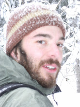
Janice on the left, Bob in the bandanna. A word on Bob. This picture was toward the beginning of the hike, one of the only times Bob looked at her map. Later as the hike took some swings and confusing turns I wrongly questioned to myself whether we were following her into eternity. I said nothing being a greenhorn and later listened to Janice tell of how Bob used to have Jim drop her off in the forest for a week at a time with only a small backpack. That was all I needed to hear.

We collectively made a decision that would define the hike, about whether to cross a ridge to access some canyons none of them had explored or simply follow the present draw to the Sipsey river. We chose the ridge. I must say that this was not the kind of guided hike you hear about birders taking or that your run of the mill conservation club sponsors. There was no planned narrative, no one person that did the talking. We all conversed about a variety of things. Janice explained things I had little knowledge of, such as carvings in ancient beech trees by native Americans, called arborglyphs, scattered in the Bankhead. She explained the increase in looting up under the overhangs where the majority of artifacts are found. Bob pointed out roads that were probably old wagon roads as they were deeply rutted and the trees growing in them were older. I got the sense, an idea stoked by Vince the day before, that in these people is a history largely unknown. The thought of losing such knowledge gained by experience and exploration is troubling. Vince had mentioned how the Forest Service had let go some of the local archeologists working in Southern National Forests, instead contracting out replacements to save money. He painfully recounted the unretrievable knowledge the forest service lost with such a short sighted maneuver.
The hike was saturated with information only the experienced can deliver. Crossing the ridge we passed the hanging nest of a migrating hooded warbler. We pushed through tangles of briars, and musclodines that always stalled the party. At points we came across beech and hickory glades, Tulip poplars the natives called Sipsey's, white and chinkapin oak, red maple, sassafrass and black walnut. Small plants of rattlesnake plantain and pipssissiwah (they said it was a Cherokee or Chickisaw name for "breaking into little pieces") Apparently natives used it to break up kidney stones.

We came up to the rim of a large canyon and had a hell of a time trying to descend into it, thinking perhaps we made the wrong choice. Bob did find a spot to slide down in, literally. We got a footing right where this beech grew around the bluff.
The canyon we had just dropped into was very remote. Everyone agreed that they were surprised to not see one sign of looting anywhere. This area had not been touched in some time.

It was here, just after we had stopped for a snack, that Janice called me to come quickly. She had startled a copperhead snake that was slowly inching away along the base of the bluff. This same area was riddled with holes of animals that had burrowed in the ground. Bob saw a box turtle under a bluff. In short it was remote and rich with wildlife unlike the compacted soils of Bee Branch.A wall of spider webs.

The hike continued for what seemed to Bob as much longer than it should have without reaching the Sipsey River. We eventually descended into a brushy floodplain and came out into a small meadow someone was maintaining for deer hunting. Crossing the meadow Ponchy ran ahead and nearly stepped on a large timber rattlesnake that was instantly annoyed and rattling continuously. I managed to get close as I felt was needed.
Some more trudging and we finally reached the Sipsey River. What we realized at this point was that somewhere along the ridgetop shortcut we were turned around and ended up coming out several miles downstream from the car. With no trail, that was a considerable distance. From here on out I thanked myself for taking the cheezits and plenty of water. I was exhausted and on the river stretch I barely took the camera back out. It was getting near dark when we finally reached an old Civilian Conservation Corps trail and came across this specie of stinging caterpillar: a packsaddle. As Jamie said seeing the picture-"It screams don't touch me."

A four to six hour hike became ten. Yet despite my tired limbs and the ticks, it was worth every step. I knew I had to get to a motel tonight. I just had to. Janice was kind enough to invite me over for a dinner of "leftovers." We picked kale from the garden and steamed it with onions and garlic, she reheated butternut squash casserole, made a fresh batch of biscuits and popped the seal on some of Bob's simply unbelievable musclodine Jam. I could not have asked for a better down home Alabaman dinner. To top off the days experience I was fumbling with my keys in the dark, trying to unlock the bed of the truck when I felt a tingling on my toes that quickly progressed into a burning, stinging fury. Fireants. We had passed their mounds of sawdust like dirt all day. They got me at long last.

Warrior Mountian Outpost

Following the morning hike in the Sipsey I figured it was time to find Mark Kolinski, Wild South's canyon mapper for the Bankhead. I knew they were located in Wren. However I drove in the opposite direction after leaving the Sispey as I didn't realize I had already driven by it. Wren sits just at the base of the Bankhead plateau a few miles outside Moulton. It is an intersection town, marked by a yellow blinking light.

I decided I would stop and ask about the whereabouts of the Wild South headquarters at a gas station/general store called the Warrior Mountain Trading Post. As I pulled into the lot I noticed two Toyota hybrids with Obama/Biden stickers, the only one's I'd seen in some time. I was getting close.

Inside it became even more obvious this store had something to do with what I was looking for. I noticed right off the bat several publications involving birding, a book on historic native American trails and after further searching, publications from Wild South itself. Pulling my head up I realized this was no ordinary general store. The back of the store was covered in taxidermy and Indian artifacts. There were fossilized plants, arrowheads, ancient tools, topo maps and guide books. I was talking with Jamie on the phone while looking at the cases. She was checking my email to find out if Mark had responded with where the HQ was and sure enough it was the Warrior Mountain Trading Post.

Asking the cashier, she escorted me to the back room where I met Vince Meleski and Janice Barret. Vince had been expecting me as Mark had sent him an email saying someone may drop by to chat. Mark was recovering from a surgery but Vice was more than happy to sit down and explain Wild South's work on the Bankhead National Forest. He went over the on the ground problems affecting the forest. Mainly the Forest Service's planting of 80,000 acres of loblolly pine plantations on what used to be mixed hardwood and longleaf pine forests. He went over the beginnings of the organization, the borderline violent contentions surrounding the initial stand against the Forest Service's ravaging tactics, particularly about clearcutting on native cultural sites. He elaborated a little about the Forest Service's past deceits, such as marking old worn down roads as functional ones to prohibit protection as wilderness. We talked about illegal ATV use, their monitoring and restoration of endangered longleaf pine ecosystems by using controlled burns. He spoke of the horrorshow of coalbed methane drilling on Southern forests, the fragmentation, the toxic ponds left over. We talked of bears, declining woodpeckers, exotic wild boars, and of course cougars. "Oh yeah, you hear of them." I had to ask whether he thought they were out there. He smiled, leaning back-"maybe." Vince had a soothing southern drawl and a calming temperment, which ws a nice respite from the few conversations I was able to have up to this point.

He is proud of their current situation on the Bankhead. There is no commercial logging taking place. All of the Forest Service's efforts are directed, with prodding and support from Wild South, toward restoration. I asked how it got to be that way when in other parts of the country, contentions are still high. He said they were lucky enough to get a forest supervisor who was interested in restoration. Since there are no current timber sales it is a perfect chance to focus funding on restoring the forest. He himself had wondered why this forest was so productive in the non-traditional way. When he asked the supervisor, he responded by saying instead of hiring the usual timber lobbyists and industry experts, I hired scientists. Interesting as we hopefully say goodbye to the days of lobbyists running the country. When Janice stuck her head in and asked if I would like to go for a hike the next day, the conversation switched to canyons and I was shown an elaborate map of the many canyons that had been explored and documented to date.

In all it was an enormous amount of information to digest. I planned on meeting Janice here again at 9am the following day for a "4-6" hour hike. Leaving the building I noticed the bulletin board by the entrance. I had not taken many pictures of the run down aspects of rural life in my travels because I didn't feel right documenting others misfortune for my own exploits. This bulletin board I regarded with the same feeling. However I caved and just before I left hurredly snapped this picture.

Alabama: Sipsey Wilderness

At 25,000 acres the Sipsey Wilderness is the largest protected area in the Bankhead National Forest. At its trailhead is where I spent the second night in Alabama. I had no idea what to expect from the Bankhead. All I had to work with was the shaded green blotch on the road atlas map. The fact that there was a guy down there working on canyons seemed interesting enought. I didn't even have a map. Luckily, I met a couple coming off the trail around dusk. The husband gave me his topo map and a brief overview of where they had been. Little did I know that this was canyon country. The Bankhead rises abruptly from the Wheeler Lake basin. It seems to me like a roughly rectangular plateau of sandstone and limestone. It is entirely forested, and riddled with canyons, etched out over millennia by creeks and rivers.

I wouldn't have known simply judging from the somewhat depressing ride in on the dirt roads, that any facsinations could exist out here. Houses and trailers were scattered along the road, many with furniture, appliances and spent cars hanging in the yards. I passed an overlook that sums up the general land ethic pretty well.
However, the people I would soon meet reassured me that there are always exceptions to the rule.

Waking early the next morning I bagged up some of my valuables and stashed them a ways into the woods as the trailhead was isolated and my truck seemed a likely target. I picked a spot on the map called the Bee Branch Scenic Area as it looked like canyon topography. I hiked for several miles down old forest service roads of caramel colored dirt, slowly being taken back from civilization. This post marks where the road used to run.
Most of the wilderness is a mix of second and old growth hardwood forest. Large white oaks stood out in the often sparse undergrowth. Shagbark hickory are interspersed with the midstory dominated by large leaf magnolia (below), giving the forest the tropical feel that pervaded in spots.A crab spider.

As I neared Bee Branch, things started to smell a little more dank. There were rhododendren and hemlocks. As I reached the top of the box canyon I looked down into the lush opening and immediately spotted, what I would later hear referred to as the "big tree." That pretty much sums it up. It is a tulip poplar, one of many in the canyon, that escaped the saw through inaccessibility.

Normally a waterfall flows over the lip of the sandstone here. But with the several year drought in the Southeast, flows are restricted to winter and spring for the most part.All of the overhangs in this area were deep and dark. Unfortunately a lot of the sensitive areas in this particular canyon have been loved to death for decades now. walking around the bluffs and overhangs I came across a few fire rings. One with tinfoil, water bottles and candy wrappers strewn about. It's blatant littering, the kind of which is tougher to find in OR or Duluth area trails. This trail was a good introduction the knowledge I was about to gain about the area. I was able to hike the next day in a far more remote area and get a feel for the stark contrast between on and off the beaten path.

Monday, October 20, 2008

The Walls of Jericho

My first stop in the Southern Appalachians was on the TN-AL border, at a place called the Walls of Jericho. Getting there entailed traveling through small town south Tennessee, skirting trembling fields of cotton as fog rose from the low hills, looking tropically verdant. Through counties worn down by entropy I drove. Past trailers that seemed to be having a never ending yard sale. Old glory waved on more of the properties than not. In stark contrast, a few new homes seemed to have been delivered from suburban catalogs. They squatted in fields of cattle or tucked up against the hills. Some stone, others in the with tall columns and epic garage bays. Ironies sprouted much as they did through Kentucky. One town's motto read "Where Progress Meets Tradition." Another similarly read: "Where Tradition and Tomorrow Meet." Questions of what defines "tradition" and "progress" beg to be answered. Some food for thought: I passed a town called Lynchburg. Borrowing from a common phrase, I wonder if rural towns throughout America can simply build a better tomorrow. The new road project outside Fayetville seems to smash through the hills, rising at least one hundred feet above the existing road. Excavators perched up on the rim like birds of prey. If progress means unchecked growth and more construction, I doubt the answer to economic woes lies within it. A feeling of abandonment clings to these towns. I passed one sign, nowhere near a church, that read "feeling down? Try Looking up."

Anyhow this first picture is only a quarter mile on toward the walls of Jericho. It is the entrance to one of many caves that pock the hillsides in this part of the world. I was a little uneasy approaching its mouth to snap a closer look.
Hiking further down the hill toward the creek I met a boisterous church group, who must have been backpacking somewhere near the walls. I met a variety of folks on the trail. Typical families, a mom with her daughters and an anxious great dane, a couple of hippyish guys, a couple with a pit bull and tribal band tattoos. All of them were extremely polite and friendly and most seemed inclined to conversate. This must be the only hiking opportunity in some distance judging by the amount of people I saw on my way out. This part of extreme northeast AL has a terribly miniscule amount of public land despite the large hils that rise abruptly from the valleys. This place, along with the wildlife Management Area adjacent makes up 50,000 acres of public land. In all that space, I bet most of the traffic happens here. This is Clark cemetery, one of many littered about Alabama. The large gravestone dated in the later 1800's. Note the smaller stones around it. Some looked only like propped up rocks. The campsite was in spitting distance from the cemetery.

The biggest beech tree I have ever seen. Somehow in all its days, no one had ventured to scrape their initials into its bark. A fitting cemetery tree. This tree was a little off the trail where the creek bottom begins to rise again.The "Walls of Jericho" are the first of many Alabaman canyons I would see in the coming days.

Tuesday, October 14, 2008

There Ain't Nothing Wrong With Nashville


I'll admit the skyline was a little more impressive than I was expecting. Luckily it was 7:30 am on a Saturday and traffic was zilch. I found a solid spot to park downtown, which I deemed safe for the day. I was a little wary of the city with all my gear but it worked out just fine.
I didn't feel right taking pictures of a lot of the people and images that stuck with me but I can write about them. There are a huge number of one man street shows. Everybody has a guitar and a favorite pair of boots. Walking around early in the morning I saw some of Friday night's leftovers. A heavy set man in a wheel chair, head tipped back, mouth agape, with a bright blue guitar resting half on his belly. There were lonely men singing country blues to passerbys who were just trying to find further excitement. The tourist district is wild. Asian couples in pink cowboy hats. Guys looking almost too western. Lots of heavy guys with necks of brick red ushering their blonde wives into the next bar or through the throngs of people on the sidewalks. I bumped in to one too many elvis statues. There were painted guitars of Honky Tonk Heroes. Bluegrass blared from what looked like electrical utility boxes on the street corners. There were Portlandesque streetkid hippies replete with dogs they could barely feed. One sign read Hungry Hungry Hippies. Every bar had live music pouring from it. If it didn't it probably hadn't opened yet. Nashville brochures glorified their live music scene saying cheesy things like "Stop in a local tavern for a live music experience you'll cherish forever!"
I heard Old Crow tunes spilling onto the streets, Merle Haggard, Johnny Cash and Hank Williams. Everything down here is a "family tradition." I stopped in pub called the Spare Fiddle around noon and watched a honky tonk band do their thing. These are Nashville musicians and they know how to play the game. They made it evident that they were playing for free. The lanky lead man came by to "shake everyone's hand" with the tip jar in tow. Same kind of way we had to work the tourists in AK. Just a bit more in your face. I can imagine trying to be a musician in this town is like looking for conservation jobs in Portland OR. There were bars everywere, tucked in alleys, perched in hotels, and everyone had a band trying to make their way. For all the touristy madness I definitely got a sense that this is a town with soul. Despite the elementary thought processes that seemed to light up the faces of listeners during songs like Titties and Beer, there was definitely a lot of talent spinning around the music scene.
The least I could do with Jamie back in Duluth was find her some cowboy boots. And that I did. Now I have bought Mukluks in AK, picked through the Taffy at Cannon Beach and walked around Multnomah falls with parents and a camera. But walking out of the leather shop in my teva sandals and grizzly bear t-shirt was a tourist right of passage fit for the most seasoned cruise line vacationer. There were troupes of girls trying on boots, oohing and aweing, with slick cowboy hatted salesmen talking about what was "hot" at the moment. "Oh red's selling big right now." Now throw me in the midst of it all and it was about as ridiculous as a scene as I can render. But they are damn nice boots!
Anyhow I felt it my duty to catch a late afternoon buzz, what with all the good/funny music, how could I not? But around 8:30 (yes I'm lame) things started to get a little crazy. Had I been with Jamie and our old Portland crew it would have been great. But alone it started feeling like I should get back moving again. That southern charm from earlier in the day was starting to get stale as the beer kept pouring. I saw some real drunk eyes and figured I had my fun. I slept the beer off in the back of my truck and got back on the highway just as the revelry was getting underway. I'll have to go back some time with reinforcements.

Monday, October 13, 2008

Crossing the Ohio River Blue


The impossibility of representing the happenings of each day is becoming obvious now. Just too much has left its impressions, not to mention coffee shops and internet are not exactly prolific in the south. Anyhow, rolling through the monotonous highway scenery in Illinois was getting pretty old so I took a state route through the country side on toward the hills of the Shawnee National forest. I went on a quick hike to get my legs moving but had to get back in the saddle if I were to make it to Nashville. I passed through small bricked downtowns where cowboy hatted men conversated on porch stoops. Going south the air was sticky, insects reverberated above the engine noise. I passed through another miniscule town when the road dipped away into a river. On the other side of the Ohio River was Kentucky, the gateway to the old south. I suddenly had that I'm not in Kansas anymore moment when I saw the Loni-Jo idling at the banks, a crew man waving me in as the last vehicle on the ferry.

The Ohio stretched out into the haze of the late afternoon, flanked by low hills of hardwoods and and some rocky bluffs. No better way to cross a legendary American river than on the humming and bumping Loni-Jo.

On the Kentucky side it became apparent that the Ohio may be more of a border than I had imagined. I stopped to get gas and the southern drawl startled me into my senses. I was down there now. I made it as far as ten miles outside Nashville where I slept in the back of the truck. As much as I would have loved to have seen Old Crow, I knew no to attempt a big city on a Friday night.

Saturday, October 11, 2008

Southbound


I knew I had reached Nachusa Grasslands when I stopped seeing corn. Four hundered some odd miles from Duluth I left the truck in a gravel parking area and stepped back in time. The Nature Conservancy's work here has preserved, through easements and acquisitions, 2500 acres of tall grass prairie that has never been touched by the plow. When I say tall grass I mean rolling hills of six foot tall grasses glowing gold and tawny. Interspersed are islands of broad spreading oaks. When E.O. Wilson makes his argument for the human affinity toward savannah landscapes it makes logical sense. Seeing the frontier vistas for my self, I fully understand. There is something so pleasing about it that I wanted immediately to live in it, to have a small home tucked in a hollow where the woods meet the grasslands. Walking along a few paths I flushed at least five pheasants, several ducks and caused scurryings I could not see. Prairie landscapes are overlooked so easily with our obsession with mountains. Imagining these grasslands stretching hundreds of miles around and you understand why volunteers give so much time to managing it, picking exotics and using controlled burns. A grain of salt on a road atlas would be sufficient in representing its size in comparison to the rest of Illinois. Prairies like this represent one hundreth of one percent of Illinois. Trevor Garrod of Tea Leaf Green writes in a song "I guess the meaning of holding on is what you're holding out against." I think the volunteers here would agree.

That first night I boiled water for a a pretty unsatisfying dinner of bowlappetite rice. Compared with the dinner Jamie and I had the night before (butternut squash ravioli and vegetable lasagna) at the New Scenic Cafe, it just plain hurt. The moon came out strong between broken clouds flowing over it like a river at ice out. Coyotes lit up the night, tossing their high pitched howls over the hills. They were everywhere, continuing their revelry as I talked to Jamie and heard about Chuck's outbursts from earlier in the day. A cold night ensued.

A badger hole maybe?