
Fortunately or unfortunately, depending on how you look at it, access to some of the wildest places is difficult. First you have sheer distance factor. Coming from CT where a long drive is an hour trip to Uconn, the thought of a 6 hour highway trip followed by twenty plus miles of rutted out dirt roads is somewhat daunting. This in mind, we packed just about every survival item we had into the bed of the truck for our first trip visit to the Owhyee canyonlands, the largest roadless area in the lower 48. Despite the lack of "roads," which out there is a tenuous term at best, we indeed were driving. With a truckload of firewood, water, camping supplies, extra clothes and a clueless dog we were pretty sure we'd make it just fine.
Having just finished Edward Abbey's "Desert Solitaire" I was amped for some canyons. I had talked with a few people that had been there, and concluded that, like they said, it must be a lot like Utah. We weren't dissapointed. After a laborious drive and a twenty mile run on rocky dirt road leading far from the last gas station, we made camp in a place called Succor Creek Canyon.  I can admit now, after weak attempts to squash any fear of rattlesnakes, scorpions, and black widows, that our first footsteps in that canyon were carefully placed. In the margins of the high walls were slopes, craggy and steep in some places, while gentle and grassy in others. After a quick bite to eat we struck out toward a ravine terminating in a jumble of fallen rock. By struck out I mean we crept. Most notable about the area other than the formidable canyon walls, was the silence. After six hours amid the hum of the truck, the wind combing through the sagebrush and bunchgrass, rattling the reeds in the creekbeds, lent a feeling of suspense. A few meadowlarks whistled, vultures turned without sound overhead. Time seemed to move slower here. Needless to say, Chuck was on a leash. The last thing Jamie and I wanted to see was our white beast tearing out of a canyon with a rattlsnake for a tail.
 I can admit now, after weak attempts to squash any fear of rattlesnakes, scorpions, and black widows, that our first footsteps in that canyon were carefully placed. In the margins of the high walls were slopes, craggy and steep in some places, while gentle and grassy in others. After a quick bite to eat we struck out toward a ravine terminating in a jumble of fallen rock. By struck out I mean we crept. Most notable about the area other than the formidable canyon walls, was the silence. After six hours amid the hum of the truck, the wind combing through the sagebrush and bunchgrass, rattling the reeds in the creekbeds, lent a feeling of suspense. A few meadowlarks whistled, vultures turned without sound overhead. Time seemed to move slower here. Needless to say, Chuck was on a leash. The last thing Jamie and I wanted to see was our white beast tearing out of a canyon with a rattlsnake for a tail.
As the dark stiffened around us and our lone neighbors retired to their rv, I noticed a noise like whitewater. I looked at the docile creek we camped beside, expecting to see rising water. It seems foolish now to thinkink back. What I was hearing was the wind ripping over the high hills south out of the canyon. We were sheltered, but with it the wind brought a feeling of desolation, seemingly the only thing moving in a big, unpeopled place. It rose and fell in waves of white sound, tumbling over the steppes, swirling just out of reach. It put us to sleep.

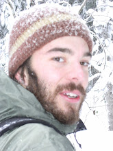
I was up early enough the first chilly morning to see the sun creeping down from the highest hoodoos to the foot of our camp. After an early morning hike we made some coffee and breakfast, packed up and moved on. I would have loved to linger a little longer there, but other places further on beckoned. We had been hoping to stumble across thundereggs, which the area is locally famous for. Thundereggs are look a lot like fossilized dinosaur eggs, hence the name. They are actually chunks of flava spewed from a volcano and rapidly cooled. Over time their innards grow a chamber of translucent, purple crystals. If you break one open, you get a cross section of glittering minerals. So of course we found none. But with temps in the 70's and the work week far away, we couldn't complain. As we drove out of the canyon toward Leslie gulch we snapped this photo.

Leslie Gulch is canyon country. The volcanic ash deposits have been eroded by wind and water leaving honeycombed rock, caves, hoodoos (pillars of rock) and all sorts of strange formations resembling anything your imagination allows. Our footsteps grew a little more confident here, although to this point it was still an entirely new environment for us.


The Cheshire Cat (aptly named and unmistakeable) Actually I probably would have missed the reference had Jamie not been there.

On the dirt road into a side canyon we met some hikers that informed us of impending rain/sleet for the night. We saw many warning signs on the drive in, cautioning about flash floods and roads that slick up with a fine mud, locally termed gumbo. As much as we enjoyed the gulches and the chance at catching a glance of bighorn sheep, the threat of rain made these washes seem more and more like dry riverbottoms, my truck using the biggest one as a road.


We later were looking through a tasteless tourism guide for eastern Oregon when we spotted a blurb on the Pillars of Rome. In the picture, photo shopped in, stood a man in red, looking like Waldo from the "Where's Waldo" books, on the very top edge of the cliff. Brought down to scale he was probably between thirty or forty feet tall.
 I think my truck looking puny at the base does it more justice.
The pillars mark a good point of reference between two environments, to the east lay the biggest roadless area in the lower 48 states, some 3.2 million acres of canyonlands and high plateaus. And ahead to our west is the northern end of the Great Basin, a huge depression of arid mountains separated by tinder dry sagebrush flats, where even the rivers never make it to the sea.